| Author |
 Topic Topic  |
|
Janko
Gambia
1267 Posts |
 Posted - 09 Aug 2007 : 13:11:08 Posted - 09 Aug 2007 : 13:11:08


|
quote:
Originally posted by brusubi
I would like to point out this map to you it is a detailed map from The Gambia in 1732 and you can find a lot of old names on them, is it possible to send an email to the National museum in Banjul so that maybe they can buy this item? I think it belongs in Gambia
Thanks very much for the map. It is hard to see clearly, maybe that is what the seller intended. If it has to do with the history of the Gambia then it should be of interest to the National museum and the rest left to historians to clarify. As you said send an e-mail so, they can see it for themselves.
Let me put some perspective to the 1700s for a better understanding of the time the map was made. By and around 1742 Europe was not clear about its own worldview so do not expect a better map of Gambia.
It was under the 1700s that Europe was secularised with the help of the ideas of the Enlightenment ( right to freedom, life and property) and laws were put in place marking the beginning of the modern times, industrialisation and so fort.
The French revolution was in 1789, when the governmental structure, previously an absolute monarchy with feudal privileges for the aristocracy and Catholic clergy, underwent radical change to forms based on Enlightenment principles of democracy, citizenship, and inalienable rights. (so call natural laws)
The American War of Independence was between 1775 and 1783.
|
Clean your house before pointing a finger ... Never be moved by delirious Well-wishers in their ecstasy |
 |
|
|
Janko
Gambia
1267 Posts |
Posted - 09 Aug 2007 : 14:39:03
|
Santanfara; thanks for your elaboration.
I start to wonder if kan, karang and afang are just dialectical differences of the same thing (speculation). On the other hand the �Kan� in Kansala (Kabu) and in Kanilai seem different from the title "Kang" some how.
|
Clean your house before pointing a finger ... Never be moved by delirious Well-wishers in their ecstasy |
|
|
|
Santanfara
3460 Posts |
Posted - 09 Aug 2007 : 17:28:52
|
quote:
Originally posted by Janko
Santanfara; thanks for your elaboration.
I start to wonder if kan, karang and afang are just dialectical differences of the same thing (speculation). On the other hand the �Kan� in Kansala (Kabu) and in Kanilai seem different from the title "Kang" some how.
JANKO ,that is ok . we are all student in mandinka . i am from bolongba ,i speak mandinka and fula dayly . |
Surah- Ar-Rum 30-22
"And among His signs is the creation of heavens and the earth, and the difference of your languages and colours. verily, in that are indeed signs for men of sound knowledge." Qu'ran
www.suntoumana.blogspot.com |
|
|
|
brusubi
Netherlands
43 Posts |
Posted - 09 Aug 2007 : 22:49:43
|
The map is authentic I believe or at least printed from an old copper plate. it is very well possible that only that places that were of interest to the Europeans were put on the map, or that there were indeed not so many places around that year. What people nowadays easily forget is that places usually were not static but moved around they follow fertile grounds or cattletracks, so in a hundred years or more a village can be moved a considerable distance.
I am a medieval archeologist and in studies conducted by our institute it became clear that a large number of settlements shifted sometimes up to a 20 kilometers in a period from 200 years!
Early African settlements are build lighter and are even more easy to shift place.
in early history double placenames occur regulary because the world from our ancestors was small and the mayority never travelled , so it could very easily occur that 50 kilometers further away you can find a similar placename because 50 kilometers was another country for our ancestors
roger |
|
|
|
kondorong

Gambia
4380 Posts |
Posted - 09 Aug 2007 : 23:11:12
|
| Thanks Brusubi. The possibilities you mentioned are posible. |
�When I despair, I remember that all through history the way of truth and love have always won. There have been tyrants and murderers, and for a time, they can seem invincible, but in the end, they always fall. Think of it--always.� |
|
|
|
Karamba

United Kingdom
3820 Posts |
Posted - 10 Aug 2007 : 00:22:23
|
Brusubi,
This is valuable input. I spent considerable time closely reading the map. I notice settle names like 'Kings Town' and thought that referred to where chiefs settled (just a guess) The name Banjul or Bathurst was not visible. There was Wuli and Kantora but Basse was not visible. Briakama and Serra Kunda are not also shown. Up country, some major towns are not shown but villages are shown. It gives the impression that some villages have been there before some towns. There is lot to the map. Quite a document. Thank you Brusubi. |
Karamba |
|
|
|
ksanneh

USA
17 Posts |
Posted - 10 Aug 2007 : 08:49:51
|
Hi Bro, How about this "Ma Kung, Mba Aya" meaning behave properly, we are at his/her's (compound,house or any form of dwelling belonging to him/her). I may be wrong but this is how I thought about it.
Kally
Sanneh-Balamang-kungbalingfing Nyancho meng teh borila ateh muru fanang.
quote:
Originally posted by Janko
Ma Kumbaya= is it a persons name (Kumba) or is it a virtue? Maa kung ning I beh m�baa ya (behave yourself when at mamma�s)
|
Ks |
|
|
|
kondorong
Gambia
4380 Posts |
Posted - 10 Aug 2007 : 18:12:06
|
quote:
Originally posted by ksanneh
Kally
Sanneh-Balamang-kungbalingfing Nyancho meng teh borila ateh muru fanang.
[
I think that era of Sanneh's have long passed. This is what Lalo Kebba said:
MALANG MBEH DOLO MIN NA, SANNEH NING MANNEL MORIYA TA. AFANG SANNEH, AFANG MANNEH, JALOLI JA KAL TA.
Besides this is what late Bun Jeng said about Nyanchos: He said that just because you are stronger than someone, you seize his property. He said Nyancho is like being a bandit. Anyone who can create mischief can also be a nyancho. |
�When I despair, I remember that all through history the way of truth and love have always won. There have been tyrants and murderers, and for a time, they can seem invincible, but in the end, they always fall. Think of it--always.� |
|
|
|
njucks
Gambia
1131 Posts |
Posted - 10 Aug 2007 : 20:11:20
|
quote:
Originally posted by kondorong
Brusubi
I have my doubts with some artifacts being sold on the internet. The map looks genuine but showed very few settlements and some deficiencies. Could it be that Gambia was virtually an empty space in 1732?
kondorong. i think the map is quite detailed. there are some of the territories (vassal states) that some of the districts in The Gambia are named after eg. Wulli, Badibu, Foni, Jarra, Kantora Toumana etc. Fulladou is missing because it did not exist at that time. Where fulladou is today is infact in the map as Eropina etc
'kings town' to me would mean where the head of some sort of local government was- chief/alkali etc. i dont know what foleykunda is , perhaps Foley is an old english word. but it seems the guy is using two names morokunda and foleykunda. perhaps one is where there are muslims and the other where there are no muslims. its interesting that an englishman is using morikunda, but i think he must have got it from his interpreter or guide.
you are right about the closeness of the settlments, because we must remember that by this time the vegetation in The Gambia must have been very thick forest as there were Elephants and other big game roaming about.
lastly today after 300 yrs we are only 1.5m people. in fact at independence we were only 250,000 people. the population explosion is only recent in the last 50yrs. a good guess would put the population by 1730 at less than 50,000. |
Edited by - njucks on 10 Aug 2007 20:15:15 |
|
|
|
kondorong
Gambia
4380 Posts |
Posted - 10 Aug 2007 : 21:12:14
|
Njuks
Since when have you turned a historian
The problem is Foley Kunda and Moro Kunda are placed all over the map and interstingly not one of these settlements exist today. That is a strange coincidence.
But 270 years of history is a long time. That is why i said in response to baldeh that jammeh is more positioned to develop Gambia than jawara in 1965. |
�When I despair, I remember that all through history the way of truth and love have always won. There have been tyrants and murderers, and for a time, they can seem invincible, but in the end, they always fall. Think of it--always.� |
|
|
|
njucks
Gambia
1131 Posts |
Posted - 10 Aug 2007 : 22:11:46
|
quote:
Originally posted by kondorong
Njuks
Since when have you turned a historian
The problem is Foley Kunda and Moro Kunda are placed all over the map and interstingly not one of these settlements exist today. That is a strange coincidence.
i'm not a historian. but i agree they're allover the place. its a puzzle and like the 'slave house' in janjanbureh let see if we will all learn something new from this.
if you look at the map closely, in Kaen (Kiang) there is Tendabar, it still exist not sure if its the same one or it has 'moved' as the Brusibi rightly said. Kower is also there probably it Kaur
i think the fact that they are all over the place implies that its not the names of the villages but rather its a way of classification.
i can just imagine a englishman with his guides trying to learn the language(s) and also map the area jotting down everything they tell him. the result will only reflect his view/understanding and not the real local situation especially at that time.
Question: does any one know how the name Bakau came about? any relation to Pakau?
|
Edited by - njucks on 10 Aug 2007 22:22:45 |
|
|
|
brusubi
Netherlands
43 Posts |
Posted - 11 Aug 2007 : 13:56:43
|
Njucks you are certainly not Mandinka, as far as I know kings and queens are common in mandinka tribes, they probably had the same type of social structure like the Ashanti in Ghana.
The present Mandinka queen lives somewhere in Holland her coronation was in 1995 in Georgetown I believe.
Mandikas tell that she is the incarnation of the famous Lion king, she is a black Surinam woman and is also a friend of president Jammeh was told in Dutch newspapers
regards
roger |
|
|
|
brusubi
Netherlands
43 Posts |
Posted - 11 Aug 2007 : 14:05:17
|

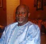
this is a picture from one of the kings dating back to 1930 king Archibong the third |
|
|
|
Janko
Gambia
1267 Posts |
Posted - 11 Aug 2007 : 15:48:34
|
Gambia has been and is still practising a farming system base on crop rotation, farmlands laying fallow for years, a system call BRING KAAMO = S�LO (Kondo) and in the case of cattle rearing HECKO. These are ways of prolonging the life of farms and pastures. Names like Konku suo, Bato kunkou, kunkou jang all indicate the separation of villages/towns from farmlands. Separating farmland from residence (homeland) increases the stability of a village or town for there is room for both prolonged use of farmland and population expansion.
The colonies were termed a �commonwealth� therefore the name Kings town is a way for the explorers to pay allegiance to the king of England on whose duty they were,the name does not reflect the conditions on the ground. Just like George Town, James Island and so fort, has nothing to do with the Gambia.
A name like Tenda/harbour (and or trading centre) is long-lasting because its related to the river whereas names like Sareh, Kerr, Kunda are more vulnerable to change because they are related to people.
|
Clean your house before pointing a finger ... Never be moved by delirious Well-wishers in their ecstasy |
|
|
|
njucks
Gambia
1131 Posts |
Posted - 11 Aug 2007 : 17:32:00
|
quote:
Originally posted by brusubi
Njucks you are certainly not Mandinka, as far as I know kings and queens are common in mandinka tribes, they probably had the same type of social structure like the Ashanti in Ghana.
The present Mandinka queen lives somewhere in Holland her coronation was in 1995 in Georgetown I believe.
Mandikas tell that she is the incarnation of the famous Lion king, she is a black Surinam woman and is also a friend of president Jammeh was told in Dutch newspapers
regards
roger
i think you're confused. i would recommend some remedial classes in west african history but first perhpas you need a simple aspirin tablet.
incarnation.............. black surinam?? |
|
|
|
Topic |
|
